Warm & Windy Monday in Oklahoma Before Storms Arrive Overnight: Here's Your Full Forecast

A strong storm system will make its way through the Southern Plains, including Oklahoma, with thunderstorm chances beginning late Monday night and continuing into Tuesday and Wednesday.
It will be a very warm and windy Monday to start, though with highs climbing into the 80s across the area. Expect a mix of clouds and sun throughout the day.
The threat of severe weather will most likely be late Monday night into early Tuesday morning, and again Tuesday afternoon and evening.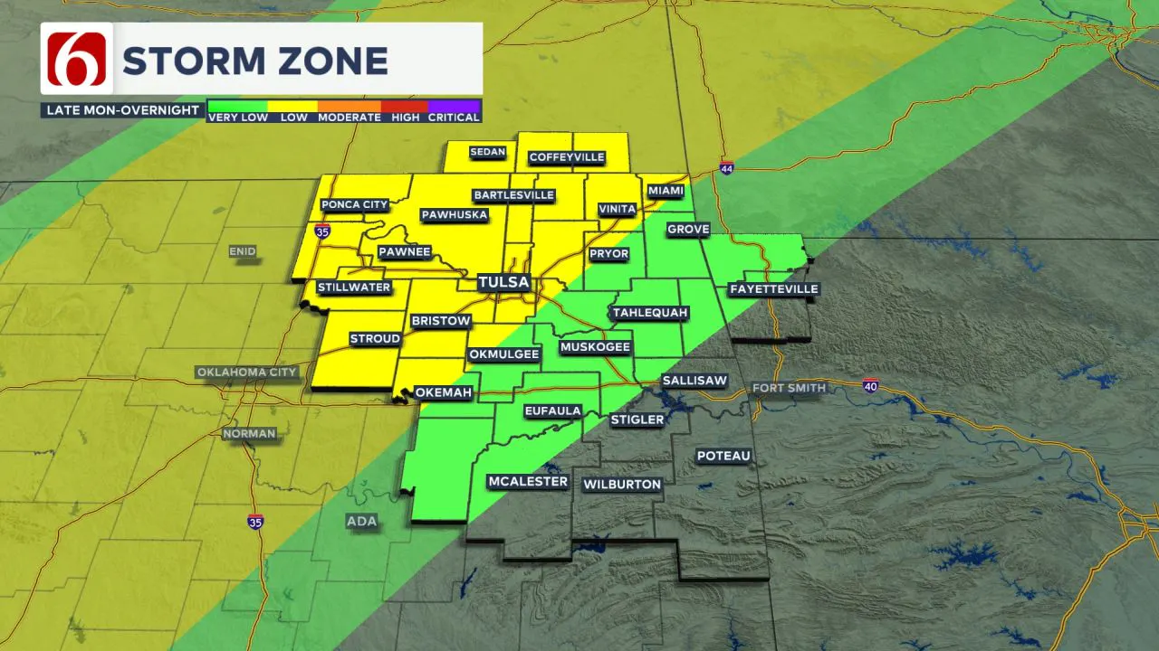 A flood watch may eventually be posted for part of the area for the next few days.
Storm Chances Today, but higher chances overnight
A dry line will establish itself across far western Oklahoma today, but a layer of warm air aloft will likely suppress most storm activity throughout the day.
A few spotty showers or storms will still be possible later this afternoon. Highs today are expected to reach the upper 70s to lower 80s, with strong south winds at 20 to 30 mph. 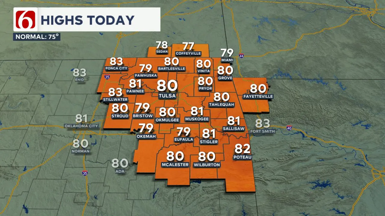 Later tonight, as a low-level jet intensifies and a cold front slowly approaches, scattered thunderstorms will begin developing southwest of the Tulsa metro.
Some of these storms will move northeast into portions of the area late tonight and early tomorrow morning, with all modes of severe weather possible.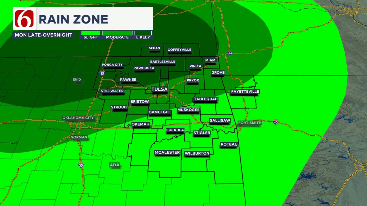
Cold Front Brings Renewed Severe Threat Tuesday
Tuesday morning temperatures will be in the mid-60s, with highs reaching the upper 60s and lower 70s in the north and upper 70s near 80 in the south.
A slow-moving cold front will arrive from southern Kansas into northern Oklahoma, bringing another opportunity for scattered thunderstorms, including some severe weather threats. 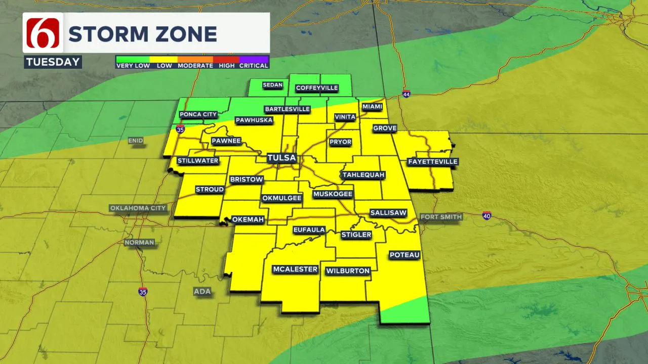 While a few showers or storms will occur early Tuesday morning, the higher probability for strong to severe storms will arrive Tuesday afternoon and evening as the cold front merges with the dry line.
Severe Weather and Heavy Rain Possible into Wednesday
Severe weather threats will continue as the front slows down late Tuesday night into Wednesday.
Another upper-level system approaching from the southwest should bring another round of showers and storms into the region on Wednesday.
Morning temperatures will start in the lower to mid-60s, with daytime highs in the lower 70s.
The highest severe weather risk on Wednesday will be along the Red River in parts of North Texas, though a few strong storms remain possible almost anywhere in Oklahoma. Locally heavy rainfall is also expected on Tuesday and Wednesday. 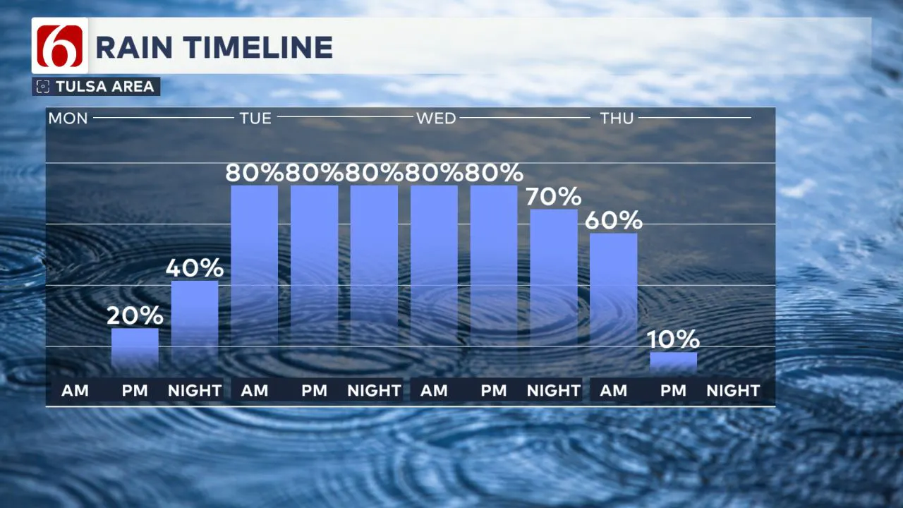
Weekend Weather
By the latter half of the week, most of the active weather will move away from Oklahoma, but another system nearby could bring scattered showers and storms Friday, before a stronger system slowly nears for the latter half of the weekend.
Weekend temps will feature morning lows in the mid-50s to near 60 with daytime highs in the 70s. A powerful upper-level storm system will more than likely impact the southern plains by the middle of next week, including severe weather threats.
The Morning Weather Podcast:
The daily morning weather podcast briefing will remain on hold indefinitely due to ongoing internal workflow issues.
We're working to resolve these challenges as soon as possible and appreciate your patience. We apologize for the inconvenience and hope to be back soon. Thank you for your understanding.
----
Need-to-know severe Oklahoma weather prep:
🔗Severe weather safety: what you need to know to prepare
🔗Tornado Watch vs. Tornado Warning: what they mean and what to do
🔗Severe weather safety: what to do before, during, and after a storm
🔗Why registering your storm shelter in Oklahoma could save your life
🔗Flood safety: How to prepare for the nation's most common natural disaster
Emergency Info: Outages Across Oklahoma:
Northeast Oklahoma has various power companies and electric cooperatives, many of which have overlapping areas of coverage. Below is a link to various outage maps.
- PSO Outage Map
- OG&E Outage Map
- VVEC Outage Map
- Indian Electric Cooperative (IEC) Outage Map
- Oklahoma Association of Electric Cooperatives Outage Map — (Note Several Smaller Co-ops Included)
Follow the News On 6 Meteorologists on Facebook!