Weather Blog: Active Pattern Continues Into Next Week

Patchy frost and fog will develop across parts of northern Oklahoma early this morning.
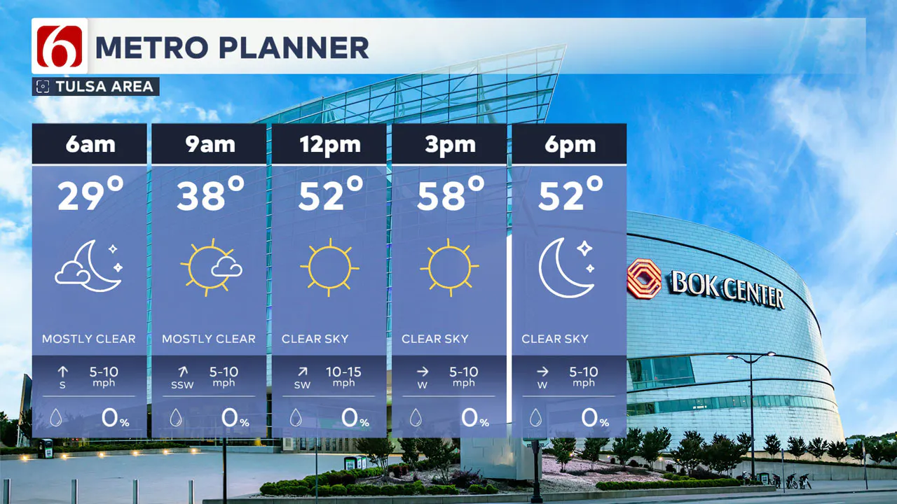
Temperatures will remain near or below freezing. While the chance of freezing fog is very low, it is not zero. Please be cautious during your morning commute.
Afternoon highs will be above normal, reaching the mid to upper 50s in many areas. Expect mostly sunny conditions with southwest winds at 10 to 20 mph before a strong cold front arrives late tonight.
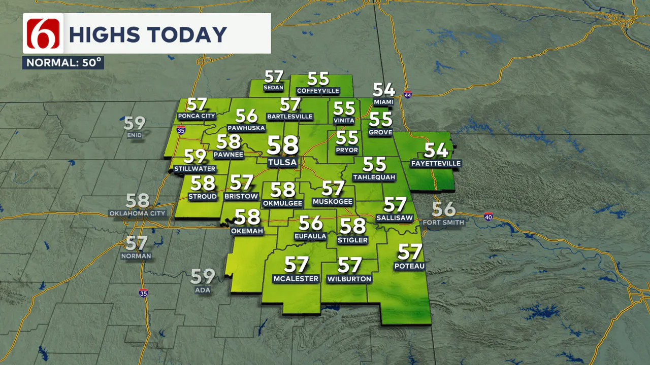
This will bring a frigid Friday and a cool weekend followed by a warming trend next week. A progressive upper air pattern will bring several storm systems across the Southern Plains next week, including the potential for thunderstorms.
Temperatures Drop Soon
After highs today in the mid to upper 50s, temperatures will drop into the mid-20s by Friday morning, with areas along the Oklahoma-Kansas state line seeing lower 20s.
A surface ridge of high pressure will build down through the Central Plains and extend across northeastern Oklahoma Friday afternoon through early Saturday morning.
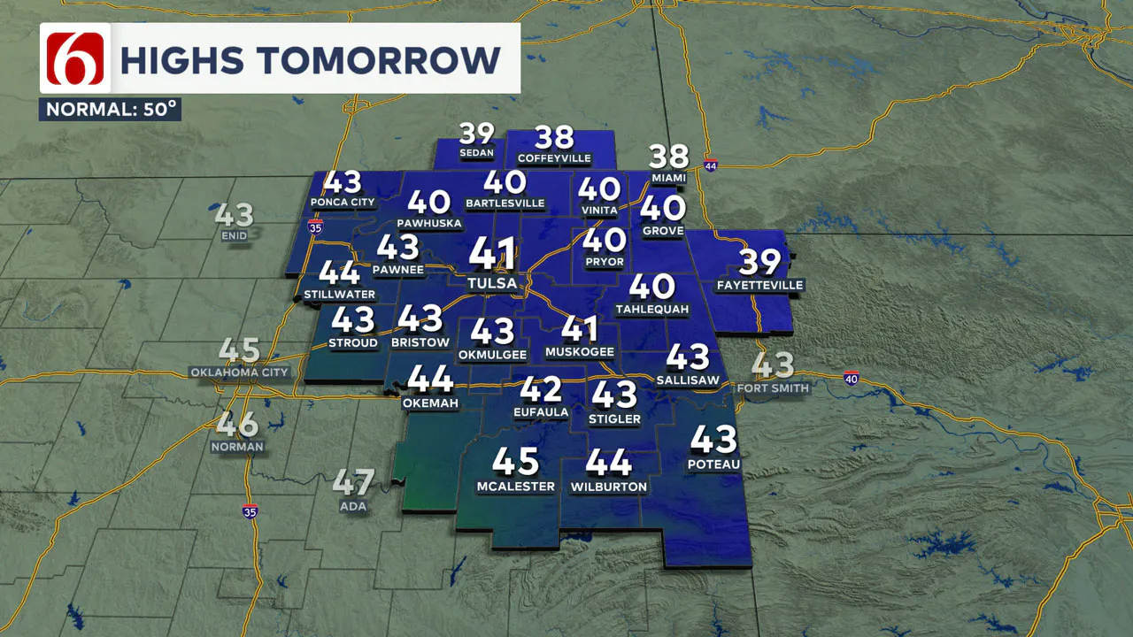
This will bring mostly sunny but frigid conditions on Friday, with afternoon highs in the upper 30s to lower 40s in the northern sections and lower to mid-40s across southeastern Oklahoma. Friday afternoon winds will be from the north at 7 to 10 mph.
Weekend Outlook
The surface ridge will be nearby Saturday morning, with some locations starting in the upper teens and others in the lower 20s. As the ridge moves east and our next storm system develops to the west, south winds will return Saturday at 7 to 12 mph, with afternoon highs reaching the lower 50s.
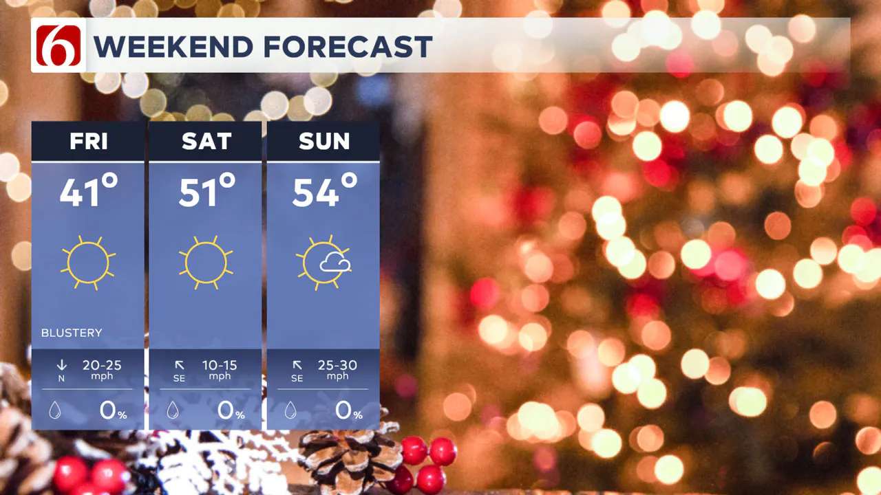
Gusty south winds are likely on Sunday, with more sunshine and highs in the mid-50s.
What Happens Next Week?
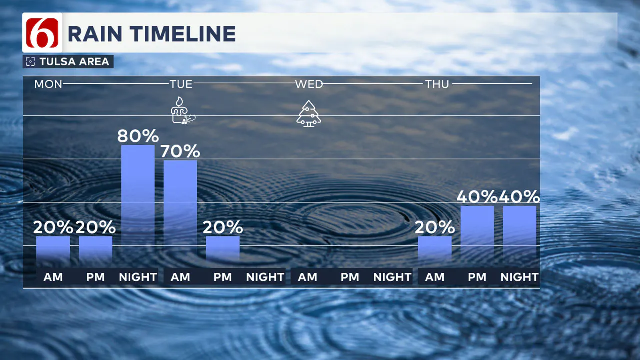
The first in a series of upper-level waves will influence our weather early next week. A few showers are possible during the day on Monday, with higher probabilities returning late Monday night into early Tuesday.
Low-level moisture will be sparse but slightly higher along the Texoma Red River Valley region. The system will provide strong dynamic energy, but low-level moisture may be insufficient for strong or severe thunderstorms.
Monday’s highs will reach the mid-50s with gusty south winds and cloudy conditions.
Midweek Storm Chances
Showers and some thunder will become more likely late Monday night into early Tuesday morning, with temperatures Tuesday morning dropping in the mid to upper 40s.
Tuesday’s highs will reach the mid to upper 50s with south winds at 15 to 20 mph.
🎄Christmas Day🎄
Christmas day will feature a low near 50 and a high near 60, with partly cloudy conditions and northeast winds at 10 to 20 mph.
The second wave will approach late Wednesday night into Thursday, bringing another round of showers and storm chances near the region.
There are significant differences in the data regarding the Thursday and Friday systems.
Additional changes to the latter half of the week’s forecast are likely as data becomes more consistent and confidence increases.
Emergency Info: Outages Across Oklahoma:
Northeast Oklahoma has various power companies and electric cooperatives, many of which have overlapping areas of coverage. Below is a link to various outage maps.
Indian Electric Cooperative (IEC) Outage Map
Oklahoma Association of Electric Cooperatives Outage Map — (Note Several Smaller Co-ops Included)
The Alan Crone morning weather podcast link from Spotify:
https://open.spotify.com/show/0dCHRWMFjs4fEPKLqTLjvy
The Alan Crone morning weather podcast link from Apple:
Follow the News On 6 Meteorologists on Facebook!
