From Sunshine to Storms: Oklahoma’s Weather Shift Begins Friday

A mid-level ridge of high pressure will remain the dominant feature in our weather pattern through Thursday. This setup will keep showers and storms out of the area while maintaining above-normal temperatures throughout the week.
By Thursday into Friday, the ridge will begin to break down and shift southeast as a strong upper-level trough moves across the western U.S. and ejects into the central part of the country by early weekend.
This transition will bring a return of storm chances, including the potential for some severe weather in parts of the region. Surface pressure gradients will gradually tighten on Thursday and deepen further by Friday, leading to increasingly gusty south winds across the area.
Back to warm weather?
Highs today will climb into the mid to upper 80s under mostly sunny skies with light southeast breezes. 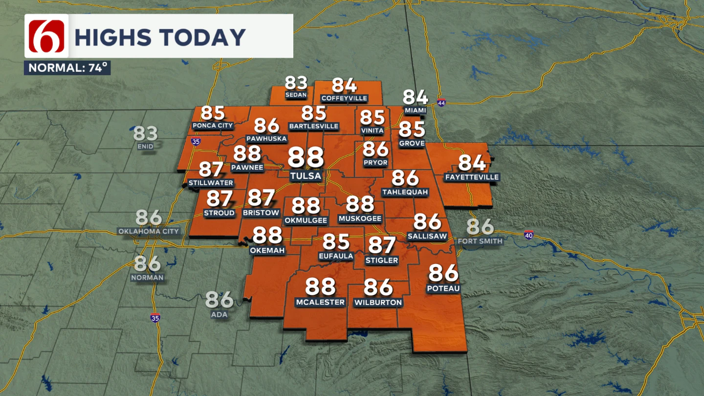 Temperatures from Wednesday through Friday will continue to run well above seasonal averages. A strong upper-level wave will eject across the Northern Rockies into the central and northern Plains Thursday night into Friday morning.
The afternoon highs will continue to be warm and above average, including tomorrow, Thursday, and Friday. 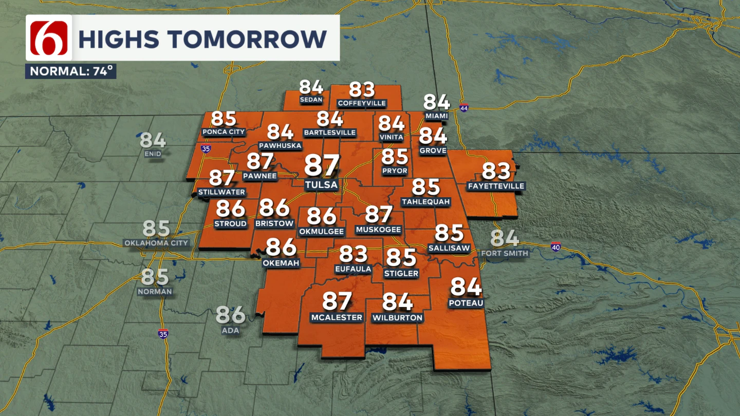 However, limited deep low-level moisture will keep precipitation chances low as this initial wave pivots into the central Plains.
When do storms return?
A more significant surge of energy arrives Friday night and ejects through Saturday morning into midday. As this second wave approaches, more substantial low-level moisture will quickly move into the region. 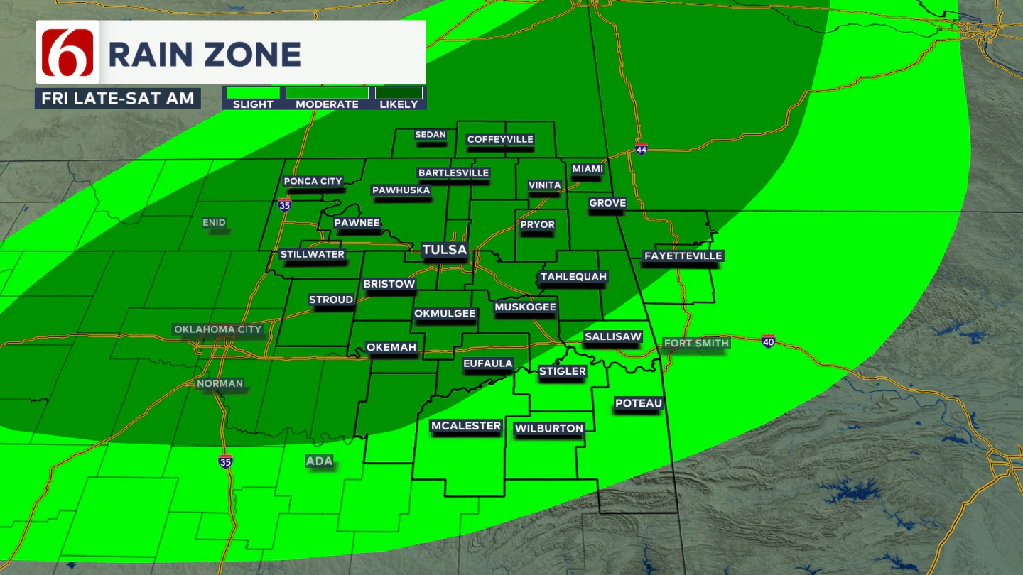 At the surface, a slow-moving cold front will enter Oklahoma Friday evening and push eastward, triggering scattered storms near or ahead of the boundary late Friday into early Saturday morning.
Some of these storms will likely become strong to severe.
Where is the best chance for severe weather?
By Saturday, the front will continue eastward across Oklahoma, with deeper moisture pooling from southeastern Oklahoma into Arkansas, Missouri, and surrounding areas.  Strong upper-level winds circulating around the base of the trough will support severe storm development, with all modes of severe weather possible given the expected setup.
The window for severe storms across eastern Oklahoma will be brief, as storms are expected to exit the state by midday based on current guidance. 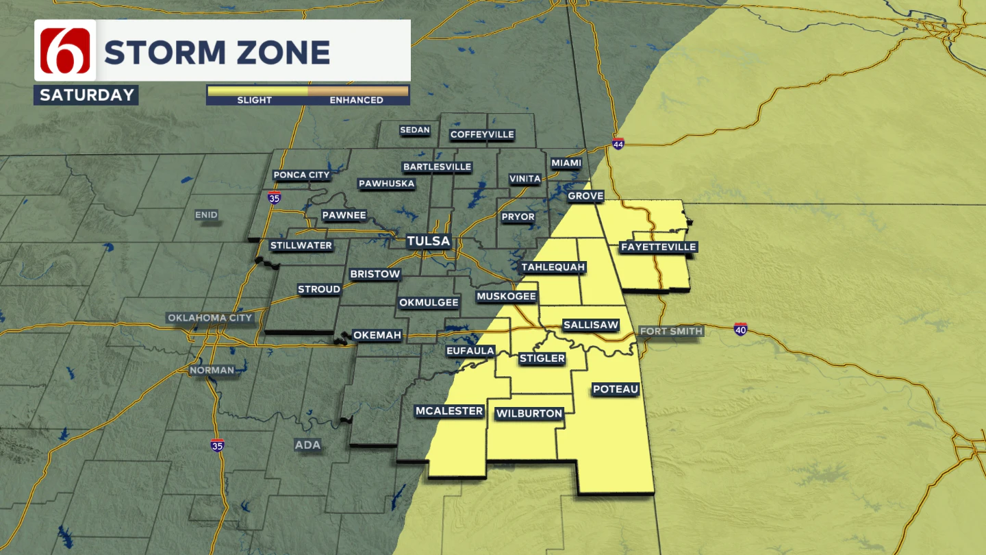 Still, the potential for severe weather will begin late Friday and persist through part of Saturday. Fall is considered our second peak for severe weather, even though severe storms can occur any time of year when conditions line up.
Over the next few weeks, expect an uptick in cold fronts and storm chances as warm, moist air continues to clash with the cooler air of the advancing season
How will the weekend and next week shape up?
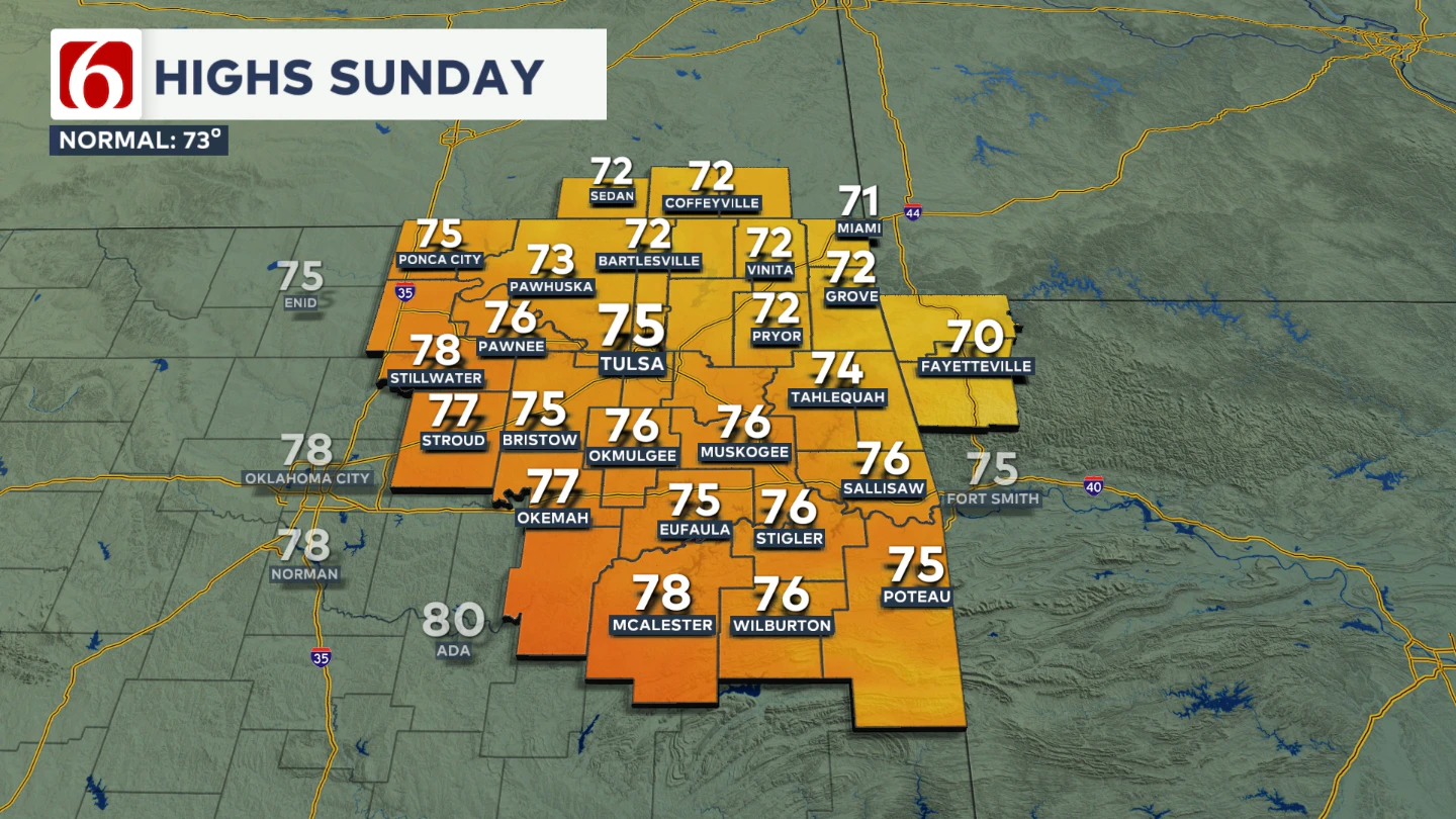
Saturday afternoon, drier air will sweep in from Kansas into eastern Oklahoma, helping push the surface front through the region. 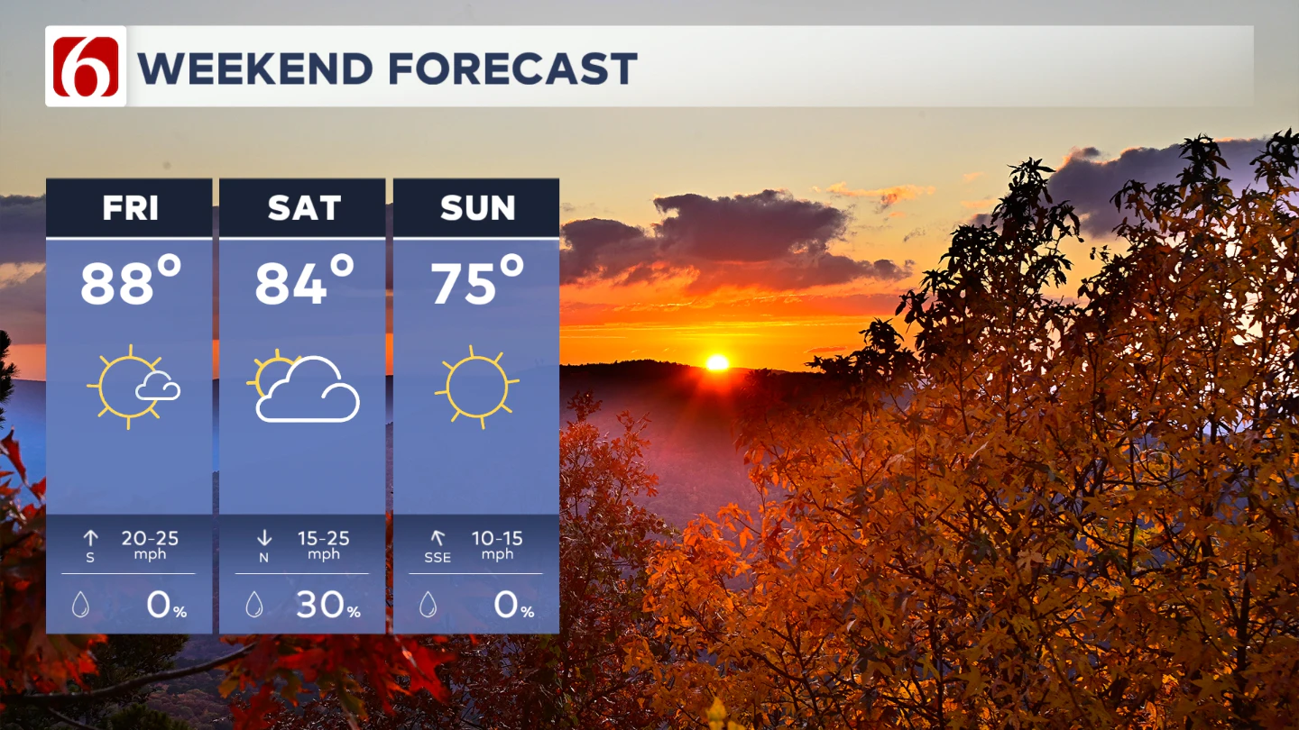 By Sunday, temperatures will settle into more seasonal, fall-like levels, with morning lows in the upper 50s and afternoon highs in the mid to upper 70s.
Is the active pattern sticking around?
Looking ahead to early next week, another upper-level wave will approach quickly. Another front will quickly move across the region next Tuesday, but moisture may be limited or to the southeast of the state.
We'll keep this frontal passage dry for this forecast update. This active pattern is expected to continue into the following weekend.
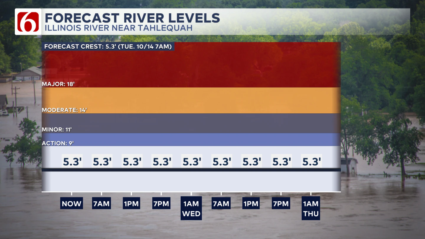
The Illinois River near Tahlequah
The Morning Weather Podcast:
The daily morning weather podcast briefing will remain on hold indefinitely due to ongoing internal workflow issues.
We're working to resolve these challenges as soon as possible and appreciate your patience. We apologize for the inconvenience and hope to be back soon. Thank you for your understanding.
Need-to-know severe Oklahoma weather prep:
🔗Severe weather safety: what you need to know to prepare
🔗Tornado Watch vs. Tornado Warning: what they mean and what to do
🔗Severe weather safety: what to do before, during, and after a storm
🔗Why registering your storm shelter in Oklahoma could save your life
🔗Floodwater kills more Oklahomans than tornadoes in the last decade, here's why
🔗'Turn around, don't drown': Flood safety tips for Oklahomans
🔗5 things to know: How Oklahomans can get federal money to install storm shelters
🔗Breaking down the SoonerSafe Rebate Program: Do I qualify for a storm shelter?
Watch us on YouTube
Follow NewsOn6 on X/Twitter for automated severe weather alert posts: @NewsOn6
Emergency Info: Outages Across Oklahoma:
Northeast Oklahoma has various power companies and electric cooperatives, many of which have overlapping areas of coverage. Below is a link to various outage maps.
- PSO Outage Map
- OG&E Outage Map
- VVEC Outage Map
- Indian Electric Cooperative (IEC) Outage Map
- Oklahoma Association of Electric Cooperatives Outage Map — (Note: Several Smaller Co-ops Included)