Weather Blog: Cool December Weather Before A Late-Week Rain Chance

Some welcome sunshine returns for our Wednesday as a mini-warming trend kicks in over the next few days.
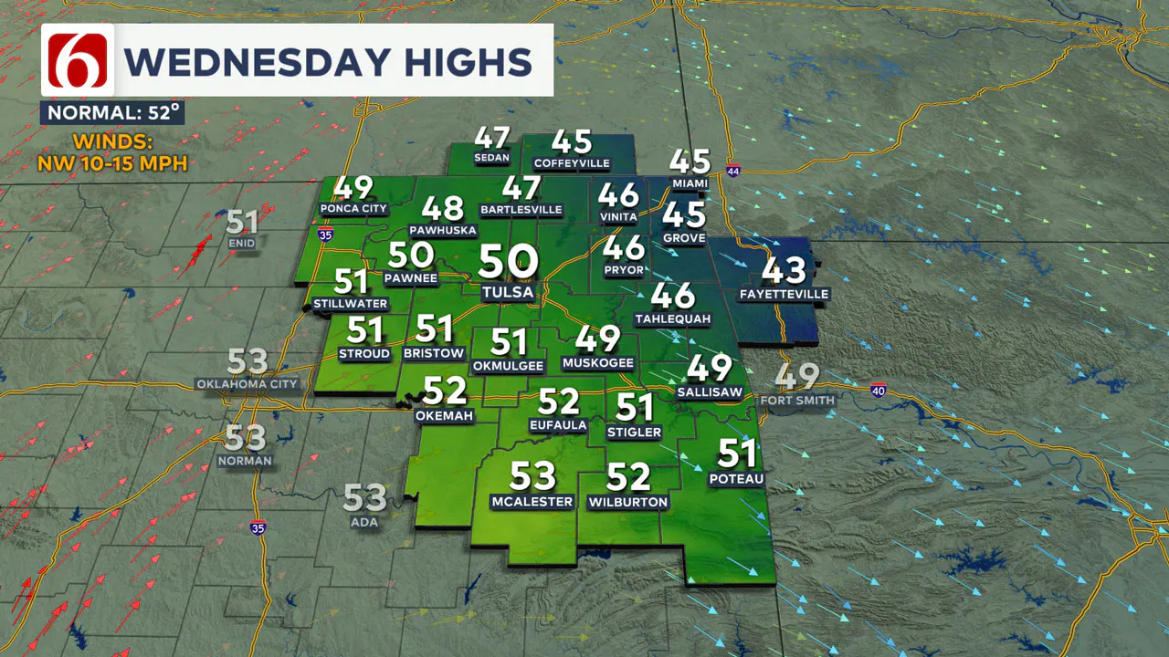
A quiet weather Wednesday should bring pretty good conditions for your midday and afternoon plans. Highs will range from the upper 40s to lower 50s across Green Country with a lighter but steady northwest breeze.

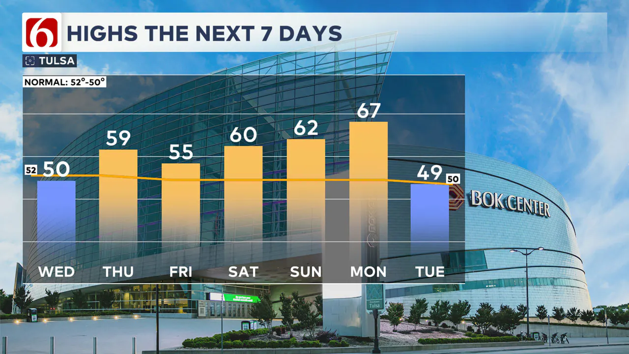
A south breeze returns Thursday, and that will usher in another brief surge of above-normal temperatures for the tail-end of the week.
Highs on Thursday look to rebound to near the 60° mark as south winds become gusty and clouds gradually increase.

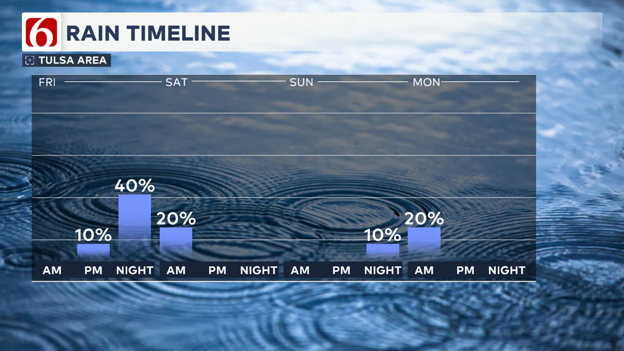
Clouds will become pretty socked in across the area by early Friday as some sprinkles and drizzle develop.
A quick-moving storm system will bring some scattered showers back into eastern Oklahoma Friday night, especially near and south of the I-44 corridor.

Rain amounts look to be relatively light with this system. Most of the showers should be exiting our viewing area by early Saturday morning.
If you like warmer weather, you should like the forecast over the weekend! Highs in the 60s look to return this weekend into next Monday before the next December cold front approaches Green Country.
Emergency Info: Outages Across Oklahoma:
Northeast Oklahoma has various power companies and electric cooperatives, many of which have overlapping areas of coverage. Below is a link to various outage maps.
Indian Electric Cooperative (IEC) Outage Map
Oklahoma Association of Electric Cooperatives Outage Map — (Note Several Smaller Co-ops Included)
The Alan Crone morning weather podcast link from Spotify:
https://open.spotify.com/episode/2d2VST1mFZENMrIF93EQlY
The Alan Crone morning weather podcast link from Apple:
Follow the News On 6 Meteorologists on Facebook!
