Fantastic Friday weather before another storm chance arrives over the weekend

The Friday Forecast
Fantastic weather arrives for our Friday as a surface ridge of high pressure settles in behind yesterday's cold front!
Morning temperatures on Friday will start in the mid-50s across much of the area, though some valley spots in far northeastern Oklahoma may briefly dip into the upper 40s before sunrise. Areas of locally dense fog will be possible across far northeastern Oklahoma.
Sunny and Pleasant Friday Afternoon
By Friday afternoon, sunny skies and a light north breeze at 5 to 10 mph will support daytime highs in the upper 70s to around 80°.

Friday should be the best weather day of the week, so get out and enjoy it!
This Weekend
The upper air flow will shift to a northwesterly direction this weekend as a weak disturbance moves across the central U.S. Our temperatures will warm back up to what's considered normal for the beginning of June.

As the next upper-level disturbance quickly drops south this weekend, it will likely trigger another round of scattered storms or possibly a complex of storms late Saturday night into early Sunday morning from southeastern Kansas into parts of northeastern Oklahoma.

Some of these storms could be strong to severe, with damaging winds and some cores of hail the primary threats. Those storms should quickly diminish by mid-morning Sunday.
Next Week
A trough will develop over the western U.S., causing upper-level winds to shift to a southwesterly direction. This setup will bring warmer, more humid air into the area and sharpen a dryline over western Oklahoma and Texas.
Storm chances will increase at times, with the potential for some storms to move into our area, including the risk of strong to severe thunderstorms even as we move into early June.

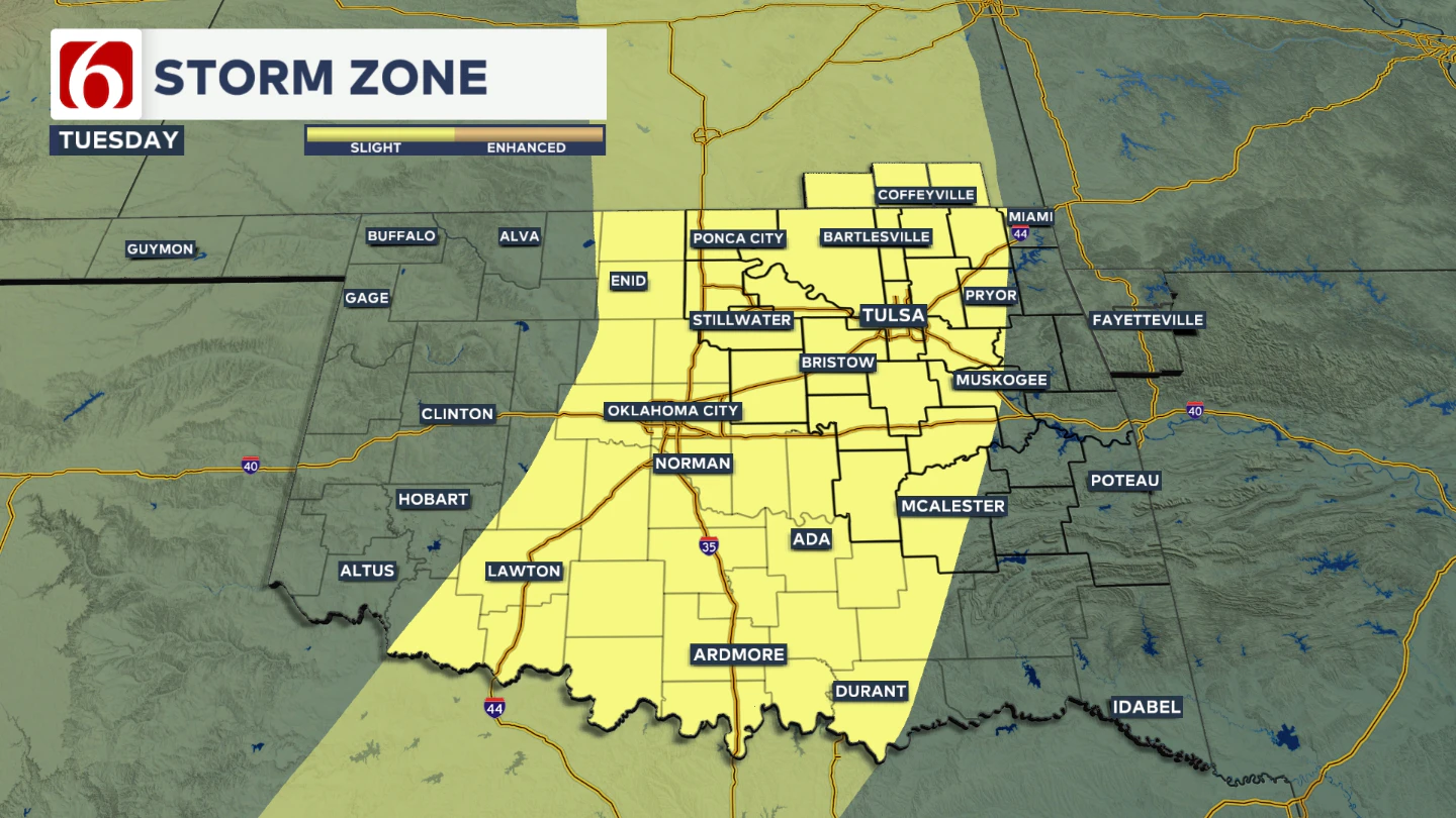
A severe weather risk area is highlighted for part of the region on Tuesday. Additional days of severe weather risks will be possible next week.
The Morning Weather Podcast:
The daily morning weather podcast briefing will remain on hold indefinitely due to ongoing internal workflow issues.
We're working to resolve these challenges as soon as possible and appreciate your patience. We apologize for the inconvenience and hope to be back soon. Thank you for your understanding.
-----
Need-to-know severe Oklahoma weather prep:
🔗Severe weather safety: what you need to know to prepare
🔗Tornado Watch vs. Tornado Warning: what they mean and what to do
🔗Severe weather safety: what to do before, during, and after a storm
🔗Why registering your storm shelter in Oklahoma could save your life
🔗Floodwater kills more Oklahomans than tornadoes in the last decade, here's why
🔗'Turn around, don't drown': Flood safety tips for Oklahomans
🔗5 things to know: How Oklahomans can get federal money to install storm shelters
🔗Breaking down the SoonerSafe Rebate Program: Do I qualify for a storm shelter?
Hot weather safety:
🔗Oklahoma heat safety tips: How to spot and prevent heat illness
Watch us on YouTube!
Follow NewsOn6 on X/Twitter for automated severe weather alert posts >>>>>> @NewsOn6
Emergency Info: Outages Across Oklahoma:
Northeast Oklahoma has various power companies and electric cooperatives, many of which have overlapping areas of coverage. Below is a link to various outage maps.
- PSO Outage Map
- OG&E Outage Map
- VVEC Outage Map
- Indian Electric Cooperative (IEC) Outage Map
- Oklahoma Association of Electric Cooperatives Outage Map — (Note: Several Smaller Co-ops Included)
Follow the News On 6 Meteorologists on Facebook!